|
|
| When arriving from Strasbourg (from the East), we go down the slope of Otterswiller and
St Nicolas Street which are descending to St Nicolas Place, where Main Street begins.
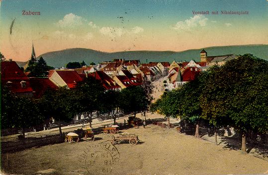
Here is the outlook you had at that time, taken from the Otterswiller slope, in front of the "new barracks" (neuen Kaserne), which are occupied today by the technical high school Claude Chappe. The left part of the street is still empty and only fields, orchards or meadows are visible here. Those were numerous around the town as we already saw it.
Saint-Nicolas Place is the crossroads were the road from Strasbourg and the road from Hochfelden arrive. This view shows the lower part of St-Nicolas Street (along the place on the left), Main Street (in front) and Hermitage Street (along the place on the right) which leads to the cemetary entrance. The place was surrounded with trees. A few years ago, there were a garage and a gas station at this place. They have been pulled down now and the place will be completely converted in the near future. It serves as a parking for the moment. The vehicles which were parked on the place at the beginning of the century were rather horse-drawn than automobile.
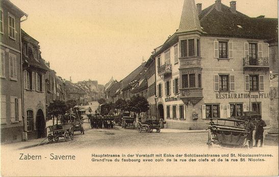
Here is the Restaurant "A la Charrue" ("zum Pflug", the plough) which still exists. It is located at the corner of Keys Street (right) and Main Street. The picture was taken after the works that were done at the beginning of the 20th century. One level was added to the building and an ugly slated arrow roof to the oriel. Notice the group of soldiers which arrives. The drums are at the head of the column. They belong to the german regiment that was quartered in Saverne at that time.
[Back to start] [Outlook on the city] [Paris Road] © Thierry Heitmann - 1997-2001 |