|
|
| From the heights around Saverne there are some unique viewpoints on the city. The postcard editors used
them many times and they published a lot of cards presenting all those panoramas.
There is even a panorama puzzle, taken from the Golden Goat Hill,
made of six postcards aligned one along the other.
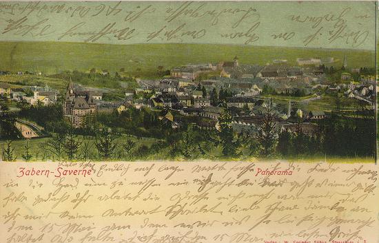
Many of these panoramas would be difficult to photograph today, then new districts were built in the empty spaces of the past. Here for example is an aerial view of the city, maybe taken from the Haut-Barr. Notice in the right lower corner, in the foreground there are trees lining a road. This road is today the General Leclerc Street which leads from the water tower to the Haut-Barr. All the meadows and orchards around this road are today built with a residential district. On the right, you can see the canal which leads to Steinbourg. In the middle, on an oblique line from left to right, there is the layout of the railway from Paris to Strasbourg. Over the railway layout, on the left, you can see the Golden Goat Hill with its meadows and orchards. Today, this hill is entirely built with houses.
The following card present a view taken from the road which leads to the Col of Saverne. You can distinctly see the factory in the foreground, with its triangle roofs. It is the Kuhn factory, manufacturer of farm equipment. Look at the beautiful great house on the left. It is called the "Château Dollinger" and is located at the entrance of the civil hospital.
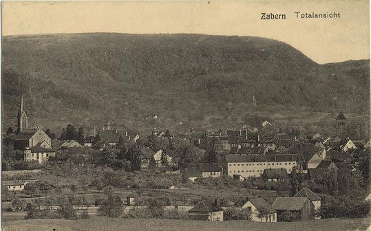
Here is now a view taken against the mountains. Left you can see the protestant church and right the catholic church. Between them (visual effect) are the great white buildings of the Holy Spirit Fathers Mission. Using the valley which you can see on the right of the postcard, a highway (the A4) was built in the 70's which passes trough the mountain, .
[Back to start] ["Gruss aus Zabern"] [The arrival from Strasbourg] © Thierry Heitmann - 1997-2001 |